Survey and Measure Land Like Pros
as a Team with GMapper
Precision land surveying and mapping made simple for professionals & everyday users.
Demo Video
Screenshot

Key Features
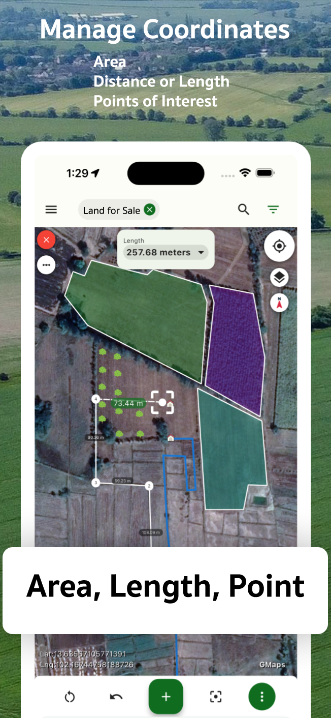
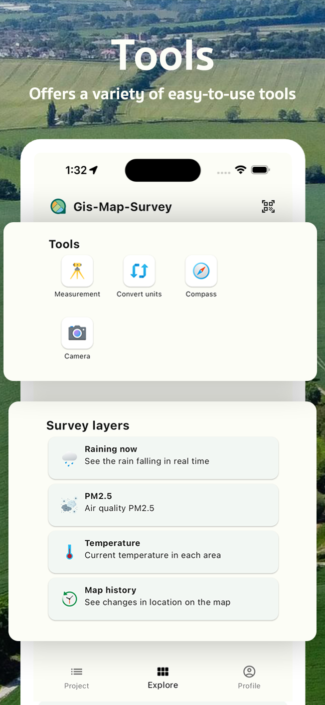
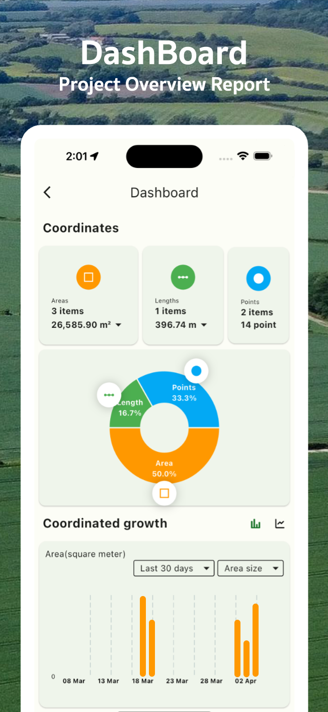
Land Measurement
Measure areas and distances with high accuracy.
Coordinate Capture
Easily mark GPS points and save custom locations.
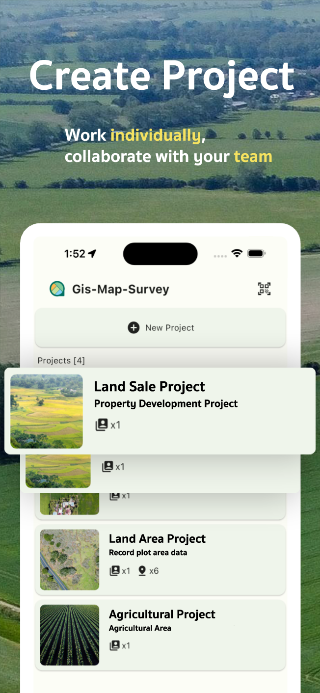
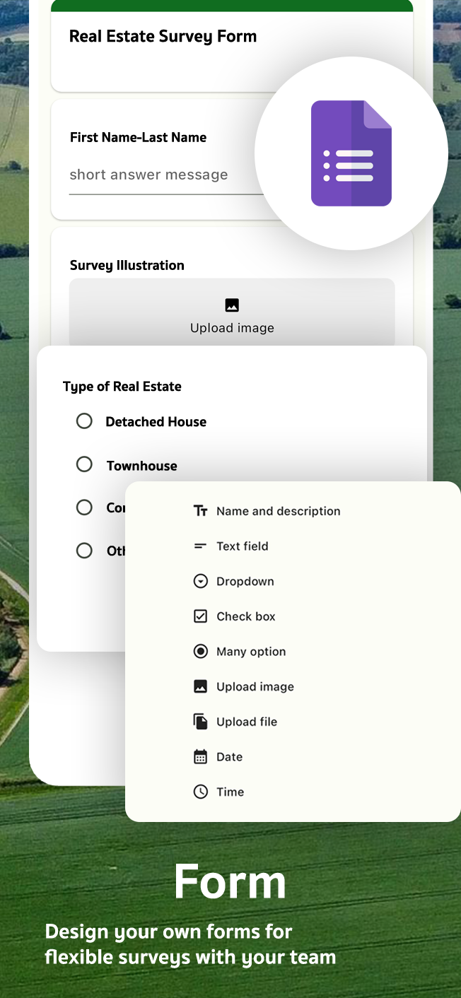
Survey Records
Log and customize your field survey data.
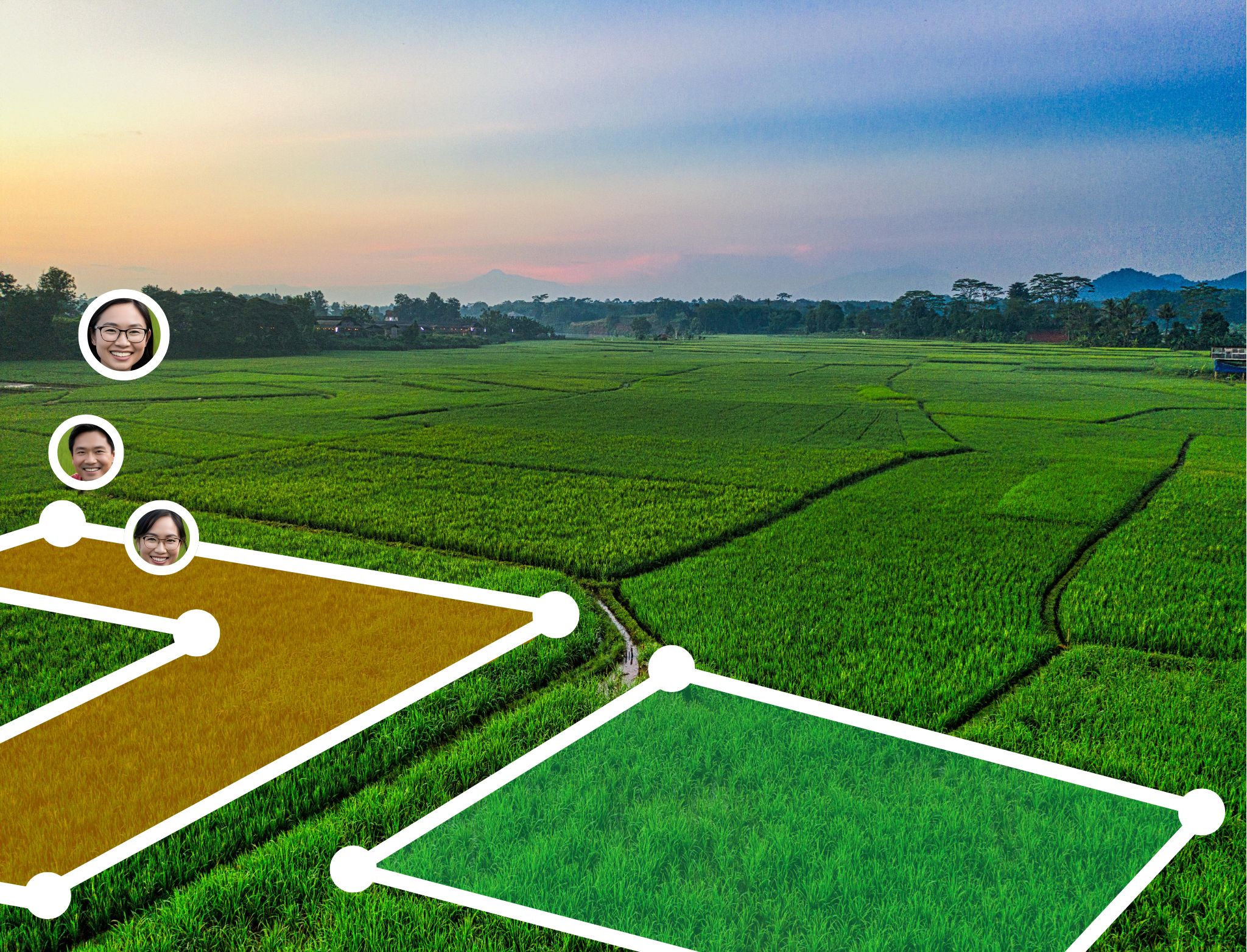
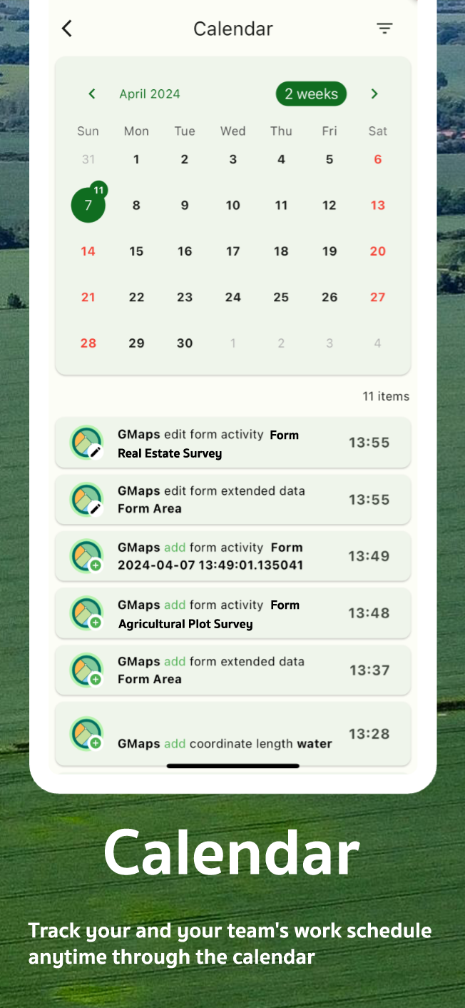
Team Collaboration
Work with your team efficiently in real-time.
Unit Conversion
Quickly convert between measurement units.
Integrated Compass
Navigate with high-precision directional tools.
Camera GPS Mapping
Use your device camera to map GPS points visually.
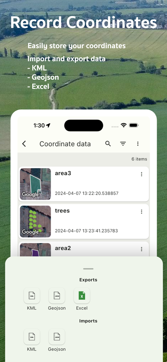
Flexible Export
Export data as KML, GeoJSON, or Excel files.
Contact Us
Get in Touch
We'd love to hear from you. Whether you have a question or just want to say hi.
Ready to Map with Precision?
Download GMapper Gis Mapper Surveys now and transform your land survey experience.
GMapper App
Works anywhere, anytime
Measure land, measure area, measure distance, collaborate, explore world maps directly from your phone

Download on the
Google Play

Download on the
App Store